
Improving Fish Passage in Oregon’s Rogue River Basin

A Rogue Basin Partnership Project


Photo Credit: Jason Jaacks/Resources Legacy Fund

ROGUE BASIN

The Rogue River runs 215 miles from its headwaters near Crater Lake…

Photo Credits: Kyle Strauss


past forests…

Photo Credit: Rogue River – Siskiyou National Forest

fields…

Photo Credit: Jason Jaacks/Resources Legacy Fund

and towns…

down whitewater-filled gorges…

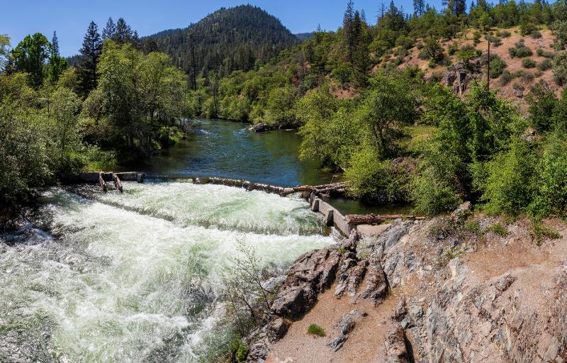
Rainie Falls Photo Credits: BLM


to its mouth at the Pacific Ocean.

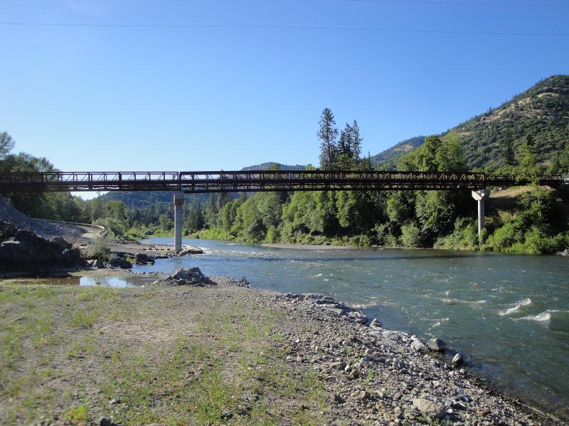
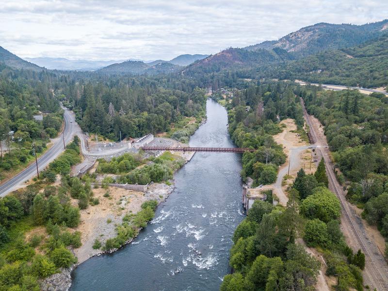
Pictured to the left: Isacc Lee Paterson Bridge (aka. Rogue River Bridge).

Photo Credit: Bridglink

Along the way, it drains a 3.3 million—acre watershed, the Rogue River Basin.

Major tributaries include the Illinois River and the Applegate River.

NATIVE FISH

The Basin is home to several renowned runs of native fish.

Important species include:

Photo Credits: NOAA Fisheries

Because of their ecological, economic, and cultural importance, this story focuses on salmon in general and coho salmon in particular.

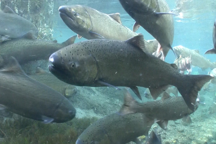
Pictured to the right: Juvenile coho salmon.
Photo Credits: Jason Jaacks/Resources Legacy Fund.

Since time immemorial, they have played important roles in the culture, economy, and religion of Native Americans.

Salmon provide food for wildlife, food for people, work for commercial fishers and fishing guides, and thrills for sport fishers.

Photo Credit: Jason Jaacks/Resources Legacy Fund

Thanks in large part to its cool waters, the Rogue River Basin produces more salmon than any basin in the United States except the Columbia River Basin.

Historically, coho habitat extended throughout large portions of the Rogue Basin.

Annual salmon runs in the Rogue Basin in the late 1880s have been estimated at 114,000 coho salmon and 154,000 Chinook salmon.

Nevertheless, by the late 1990s, wild coho salmon runs in the Rogue Basin had dropped to less than 10% of the late 1880s estimates.

Juvenile Chinook salmon typically begin their seaward migration within 3-6 months after hatching while coho salmon typically spend on the order of 15 months rearing and occasionally as much as 27 months. Juvenile steelhead might spend as many as 4 years in freshwater, depending on water temperature, before migrating to the Pacific Ocean.

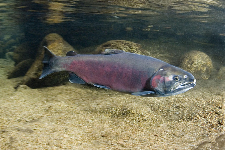
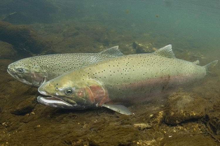
Pictured on right: Juvenile Chinook salmon

Photo Credit: John McMillan/NOAA

The presence of cool water is not enough on its own to ensure healthy over-summering habitat conditions for coho salmon and rainbow trout. These small fish may need to move upstream towards headwaters or springs during the heat of the summer to stay in suitable cool water.


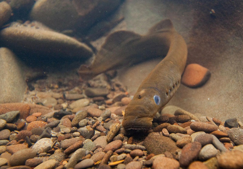
Juvenile blocked at Coleman Creek barrier
Video Credit: ODFW

For more videos, visit the ODFW site here.

For these juveniles, road culverts and small diversion dams with “jumps” as low as six inches, which pose little problem for adult fish, can thwart movement to cooler water temperatures.

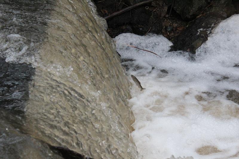
Photo Credit: Scott Howell

Removal of barriers that impede coho salmon provides access to important habitat for other native fish and aquatic wildlife. Projects that restore fish access also restore natural processes like movement of sediments (like gravel, sand, and silt) and logs.

DAM REMOVAL

In the Rogue Basin, the efforts of many partners over more than 20 years led to the removal of three large dams on the mainstem Rogue River and three large passage barriers in two watersheds that provide a lot of coho salmon (and steelhead) spawning and rearing habitat.

The largest of these barriers was Savage Rapids Dam. It was a 39-foot-high, 500-foot-long structure that spanned the Rogue at River Mile 107. The structure’s fish ladders and screens did not meet current standards, and at times the dam completely blocked upstream fish passage.

Text Credit: WaterWatch of Oregon

After a 21 year battle led by Fish Passage Working Group member WaterWatch of Oregon, the dam was completely removed in 2009. The dam’s irrigation diversion function was replaced by a modern pumping system. Removal has increased salmon and steelhead populations in the basin; stimulated economic activity in local communities; and eliminated a barrier to recreational boating.

Text Credit: WaterWatch of Oregon


Pictured to the right: Savage Rapids Dam Before Removal
Photo Credit: WaterWatch of Oregon

Pictured above: Savage Rapids Dam After Removal

Photo Credit: WaterWatch of Oregon

Related restoration activities have included permanent protection of substantial streamflows and riparian revegetation.

Pictured to the Left: Riparian Restoration at Savage Rapids Dam Site (downstream view)
Photo Credit: The Freshwater Trust

Photo Credit: The Freshwater Trust

Pictured Above: Riparian Restoration at Savage Rapids Dam Site (upstream view)
Photo Credit: The Freshwater Trust

The other large barriers were:

  • Gold Hill Dam
  • Elk Creek Dam
  • Gold Ray Dam
  • Wimer Dam
  • Fielder Dam

To learn more about the removal of the large barriers:


CLICK HERE

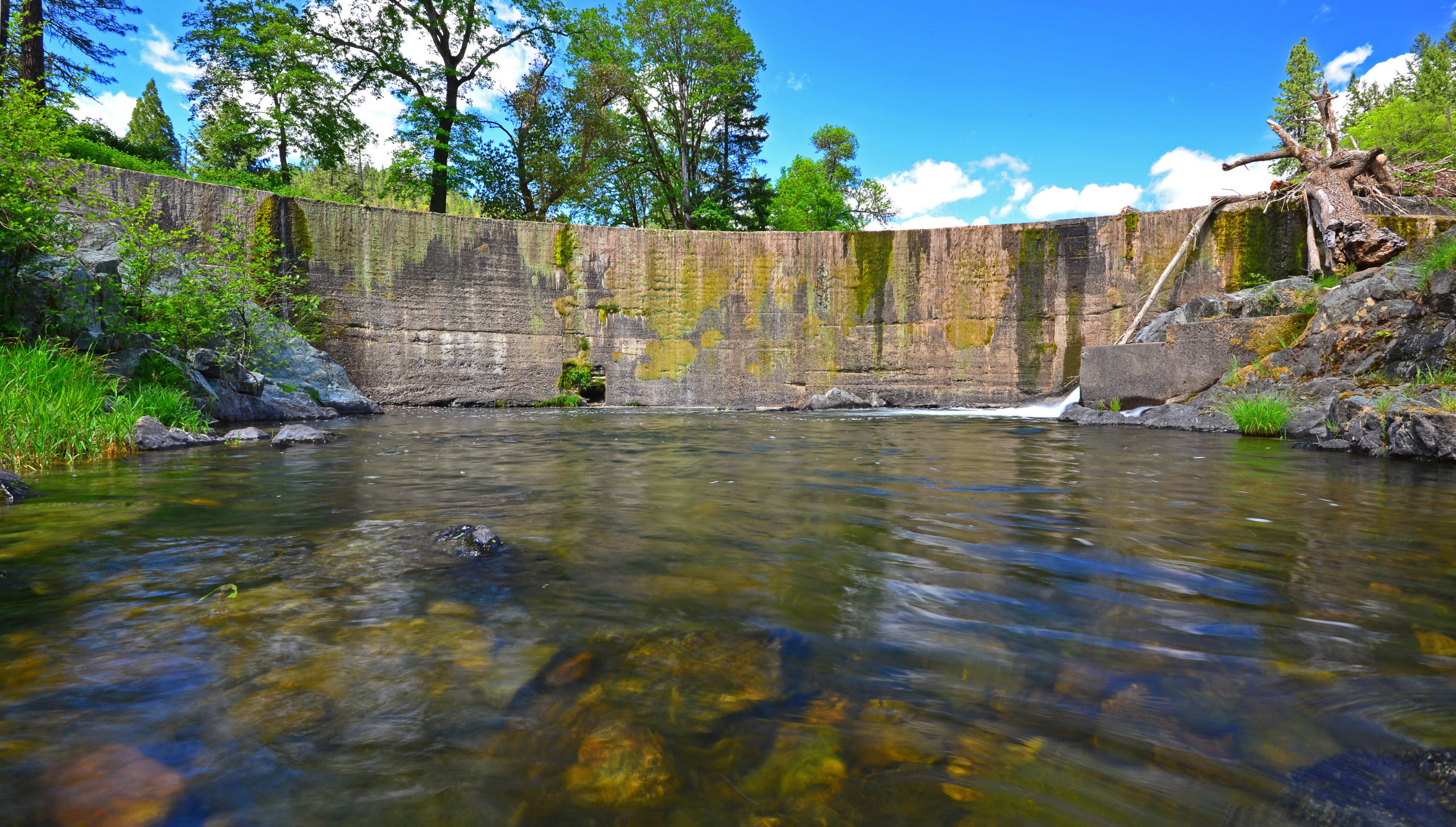
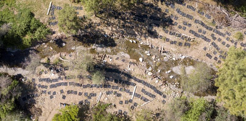
Photo Caption: Fielder Dam

Photo Credit: Scott Wright/River Design Group 

Fish Passage improvement projects completed since 1995.

Since 1995, there have been over 110 completed fish passage improvement projects in the Rogue Basin.

With the removal of the large barriers, attention has turned to smaller barriers on tributaries of the Rogue River.

Blue dots represent fish passage improvement projects completed since 1995.

The Oregon Department of Fish and Wildlife included 89 Rogue Basin barriers on its 2019 list of the top 589 fish passage barriers statewide—more than any other basin.

There are three main types of barriers: channel spanning dams, push-up dams, and culverts.

Yellow dots represent 2019 ODFW Priority Fish Passage Barriers.

2019 ODFW Priority Barriers

RECENT PROJECTS

Two recently completed projects were the removal of Beeson-Robison Dam and Forest Creek Dam.

Both projects were made possible through the cooperation of the landowners and water rights holders.

Beeson-Robison Dam was on Wagner Creek, just west of the city of Talent, OR.

Video credit: Jason Jaacks/Resources Legacy Fund

Rogue River Watershed Council removed the dam in 2018. Because the dam provided water to 19 water rights holders, the project included installing a new irrigation intake system for continued diversion at the dam’s former site.

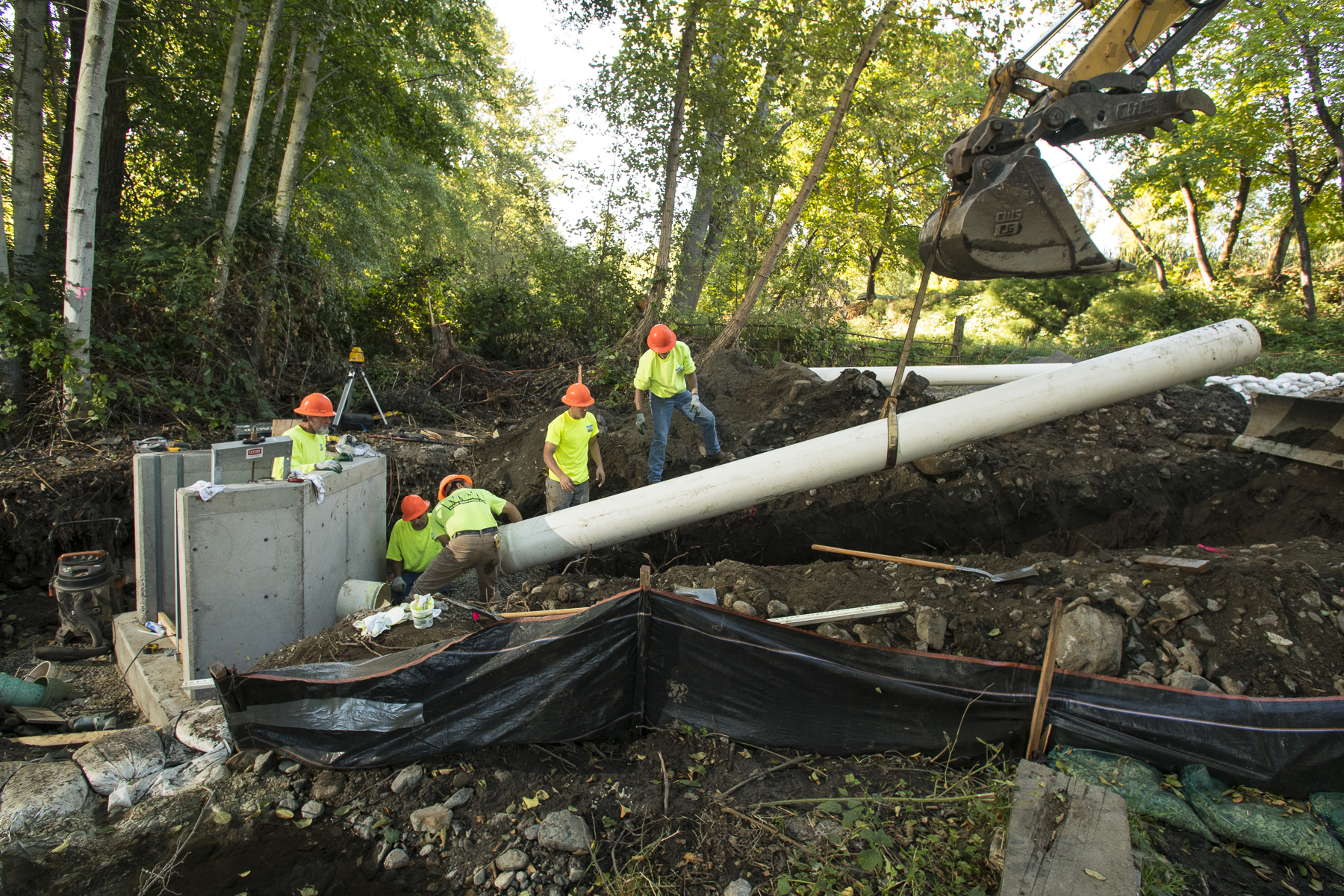
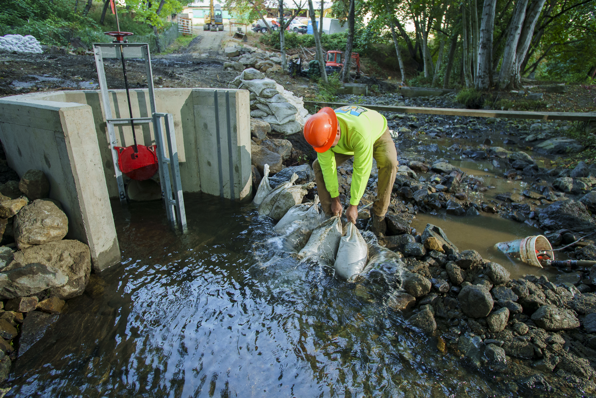
Photo and video credits: Jason Jaacks/Resources Legacy Fund

Following dam removal activities, native trees and shrubs were planted along Wagner Creek in the areas disturbed by construction.

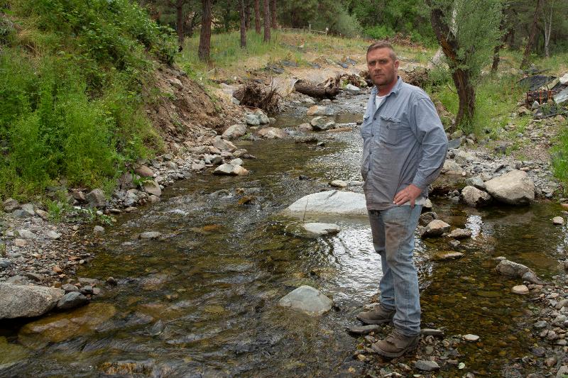
Water right holder Bob Hackett

“The water delivery is better than it was. It’s more efficient than it was. Just even maintaining it is 1,000 times easier. . . . From my perspective, there really isn’t a negative.”

– Bob Hackett, water user on Wagner Creek, on the removal of Beeson-Robison diversion dam.

Simultaneously, just downstream, RBP member Jackson Soil and Water Conservation District replaced the Parrish-Rapp [check with JSWCD] seasonal “push up” dam with a pumping station. This amplified the positive effect of the upstream dam’s removal by improving passage up to the Beeson-Robison Dam site.

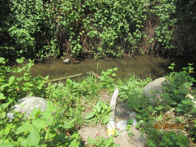
Photo credits: Jackson Soil & Water Conservation District
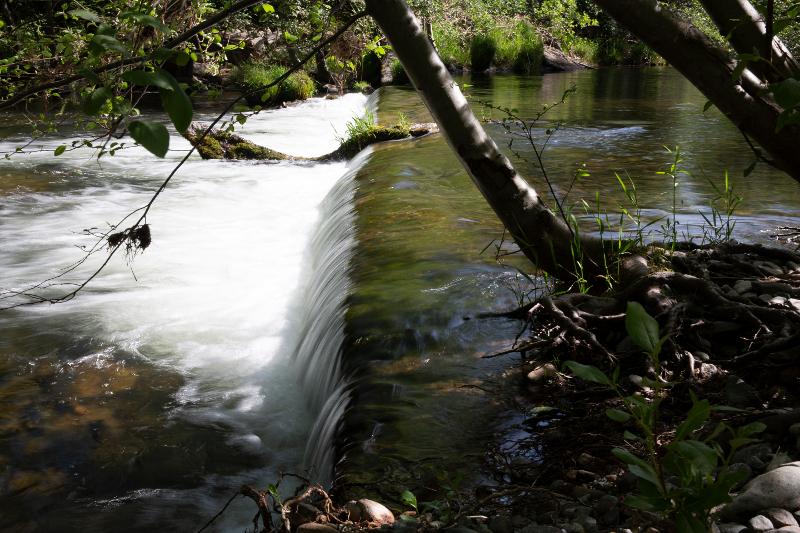
Forest Creek Dam was on Forest Creek, in Ruch. The dam was removed in 2018. The project included riparian restoration and stream channel improvements to further aid fish passage.

Forest Creek Dam

Photo credits: Jason Jaacks/Resources Legacy Fund

Tom Maddox, Ruch Sawmill

”I found APWC to be genuine in their concern for the condition of the creek and fixing any issues, such as erosion, habitat loss, and of course future fish production, meeting our criteria for this project was also very appreciated.”

– Tommy Maddox, agent and family member, for the Ruch Sawmill property and the Forest Creek Dam Project.

IS IT WORKING?

Is it working? Here are some early answers.

On the mainstem of the Rogue River, upstream of Savage Rapids & Gold Ray Dams, in most years since the removals, spawning surveys have observed a large number of redds (spawning sites) upstream of the former dam sites.

On Bear Creek, since the Jackson Street Dam was removed in 1998, direct observations describe Fall Chinook salmon, Coho and steelhead reaching an additional 16 miles upstream.

On Jones Creek, after removal of the Tokay Canal Dam, fish traps have found more steelhead fry in drought years.

On Evans Creek, following removal of the Fielder and Wimer Dams, initial spawning surveys show Chinook salmon spawning higher and Pacific Lamprey increasing in abundance and distribution upstream of the former dam sites.

Fish are now reaching habitat that had previously been inaccessible.

ONGOING EFFORTS

Currently, members of the Fish Passage Working Group are pursuing work on multiple sites. These include:

McKee Diversion Dam

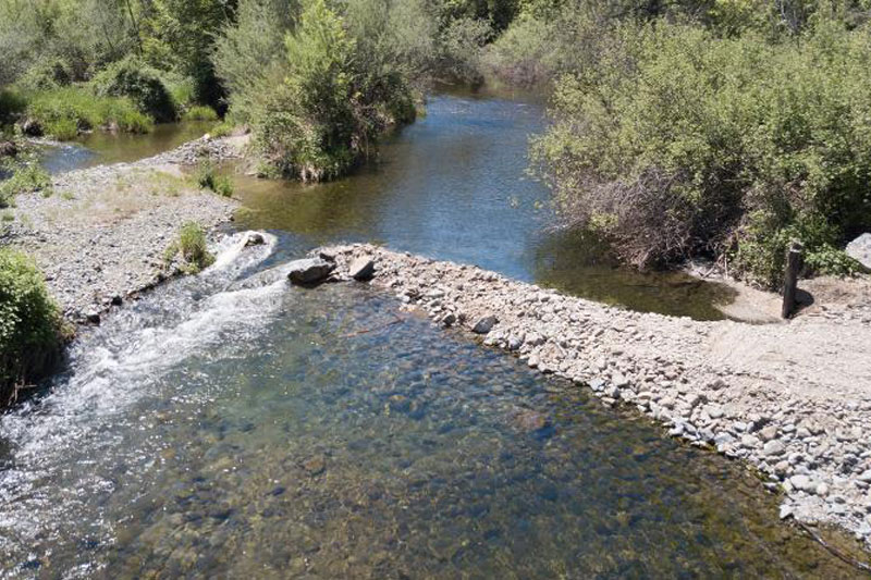
Bridgepoint Diversion Push Up Dam

Wimer Siphon Dam

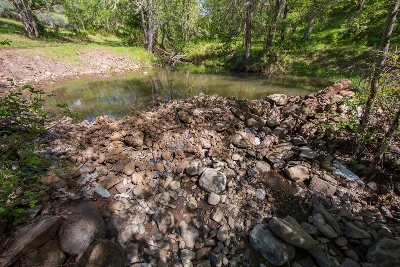
Push up dam on Salt Creek at C2 Ranch
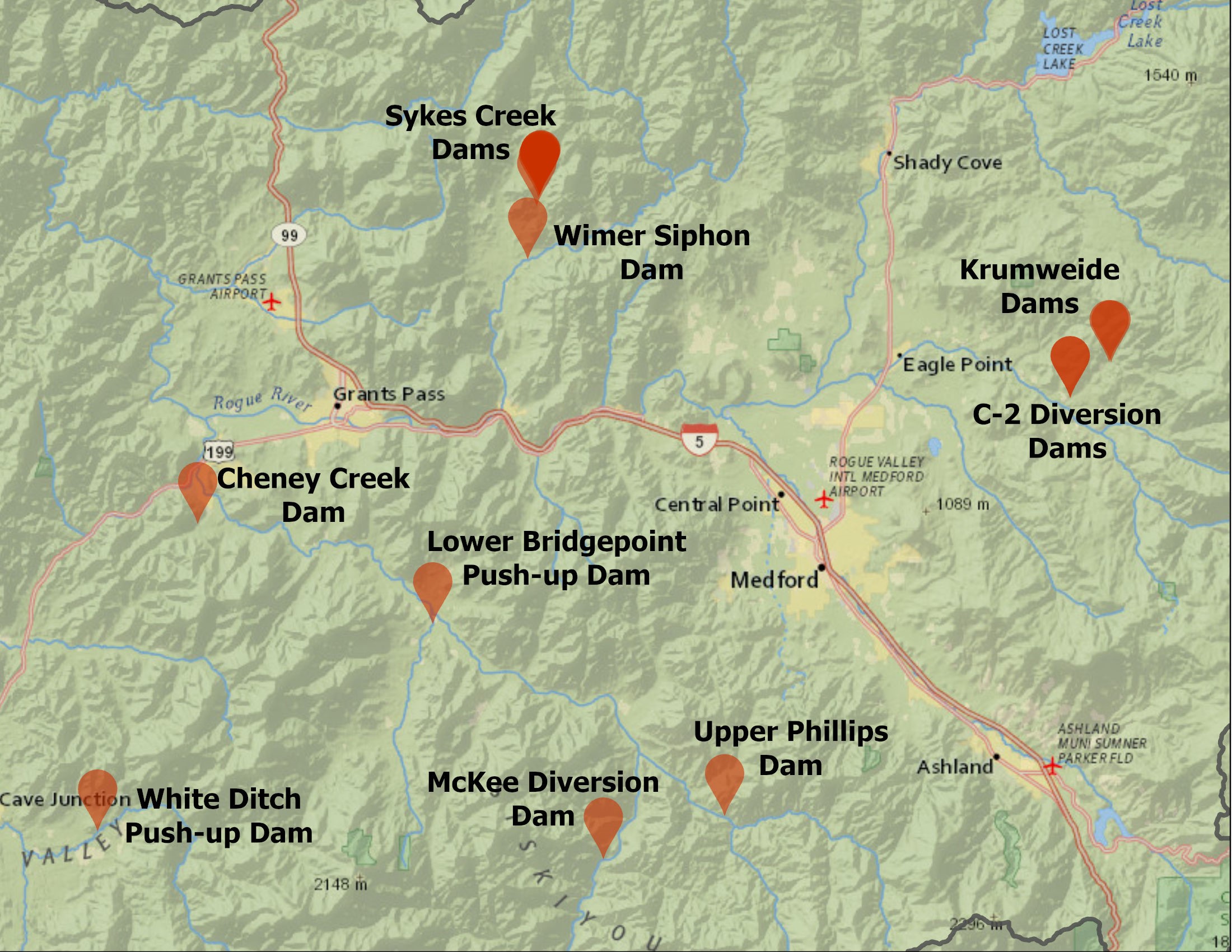
Click below to learn more about our ongoing passage improvement efforts:

ONGOING PROJECTS

Thanks to our Members

Special Thanks to our Fish Passage Improvement Funders

This Story Map was made possible by the generous support of the Oregon Watershed Enhancement Board, the Resources Legacy Fund, the Rogue River Watershed Council, and the tireless efforts of mapmaker extraordinaire, Nikki Hart-Brinkley, Rogue Valley Council of Governments, and our web developer Laurel Briggs, Creative Marketing Design.

Learn More

To learn more about our plan to improve the Rogue Basin for all who love the outdoors, click below to access our Action Plan:

ROGUE BASIN ACTION PLAN

To find out how to get involved or how to make a donation, click below to contact us:

CONTACT US

Photo credit Jason Jaacks/Resources Legacy Fund